Wednesday, 23 August 2017

Leaving Canada


We found that Shelburne, Nova Scotia, is not an easy town to leave, just like about half the population who claims Ontario to be their original home province. Our new alternator failed, and we had to wait for a replacement to be delivered from Bridgewater. Ready to go, but hurricane Gert was making waves in the Atlantic as she passed offshore. More waiting. The quest to move south must continue, so finally a weather and tide window emerged, and we left the safe harbour as advised, two hours before high tide in Shelburne so we would pass Cape Sable at slack ebb tide and catch the “Fundy Express” across to Maine!


As we rounded Cape Sable, I checked for a weather update, and the winds had changed for the worse, so we found a place nearby to hide out.
We anchored in Barrington Passage for the night to weather out a big wind.
Our plans would change again, almost like we were being lured to see more of this beautiful province!  Our weather and tide window shot, we instead made way to Yarmouth one day, and Westport on Brier Island the next. Both days involved waking in the dark and navigating with radar and chart-plotter for hours until the fog lifted or the day dawned. And this is how we are getting closer to crossing the imaginary line between Canada and the United States.

 
The light house on Cape Forchu outside of Yarmouth, Nova Scotia

Fishing boats in Yarmouth Harbour


Dawn on our way to Brier Island ant the tip of Nova Scotia's Digby Neck.

Lobstering is huge in Westport.

We were fortunate to catch a free mooring in Westport so we didn't have to contend with the tidal range.


We took a mooring in Westport Harbour at high tide and in 40 feet of water, and found hours later we were in only 15 feet. The scenery along the shoreline had changed so significantly with the change in tides! 


It was day 101 after leaving the North Channel Yacht Club, and we got our documentation in order to cross the border.  We reflected on our journey out of Canada, and all of the beautiful places we’ve seen and the wonderful people we’ve met. It was way beyond our expectations! On August 22, 2017, we will cross into the USA!.

Sunday, 13 August 2017

South Coast of Nova Scotia


Saturday, August 5th, 2017, we woke in Lunenburg Harbour, again shrouded in thick fog. The weather forecast indicated that it would lift, so around 10 a.m. we raised the anchor and motored into Lunenburg Bay toward the “Ovens”, a couple of huge sea caves on the south shore, conveniently on our way. 
Foggy morning in Lunenburg as we prepare to leave port.
The wind picked up and we sailed around the corner and continued southwesterly to the LaHave River, where we anchored off the Kraut Point fishing wharf and a nearby shore offering protection from the wind and waves.
Fishing boats at the wharf at Kraut Point


The next morning we continued, but the winds had created quite a swell, and the wind direction required us to be close hauled, something the autopilot doesn’t deal with very well, so we hand-steered almost the whole day.  The wind averaged 15-20 knots (30-40km/hr) and the waves were building on an ever-increasing swell, then breaking, when dense fog rolled in! Back home fog was usually associated with calm winds, but here it comes in anything!  Never a dull moment! With the radar on, straining our eyes and ears, we navigated into Port Medway, and just as the trickiest part was done, the fog lifted.  We anchored an relatively calm waters close to the town of Port Medway, but stayed on the boat.


Monday morning the forecast was for westerlies in the morning, a suitable wind direction to move down the coast, so we hurried up and made coffee and breakfast while we were underway. Close-hauled again, the wind increased as the day went on, reaching 27 knots, and the waves increased in size in an angle to yesterday’s swell.  Tired of the pounding we were taking, we cut into Port Motoun (pronounced “Matoon”), as the Down East Circle Route Cruising Guide stated a beach here, Carter Beach, is likely Nova Scotia’s most idyllic beach.  We had to check it out!  We were very surprised, arriving near low tide, that the beach was amazing, long and wide. White sand (see the pictures!) for 3 coves, with sand dunes, and no development. In the Caribbean, it would have been lined with resort hotels.  After we were comfortable that the anchor was holding, we dinghied into shore for a long walk on the beach. There were granite boulders on the fringes similar to the Baths in the Virgin Islands or the Maldives. Beautiful!  Apparently, this beautiful beach wasn’t a secret, because there were a lot of people on it.
Carter Beach on Port Motoun


Fresh mackerel! Yum!


When we returned to the boat, 3 locals that had been out mackerel fishing stopped by to offer us part of their catch! We gratefully accepted 2, and we quickly had them cleaned and on the grill!


Tuesday’s forecast called for high winds overnight so we had to look for a well protected spot. We found it at Lockeport, where their harbour is fully enclosed and safe in all winds. We stayed a rare night at a dock at the White Gull Restaurant and Marina, but found, contrary to the cruising guide, it had no diesel, no water and no power. We later noticed that a neighbouring Wharf, part of the marina, had power outlets, and moved over there, tying spring lines to deal with the 5 foot tidal range.
Historic residences in Lockeport


Wednesday, August 5th, we made our way to Shelburne, Nova Scotia. We anchored south of the Shelburne Harbour Yacht Club’s mooring field, in front of historic Dock Street.  Tied to moorings, and crowding the docks were a number of schooners, which we later found out gathered in Shelburne this year for their annual schooner race week.  After anchoring, we went to the yacht club and for a walk.
Schooners taking part in the daily races!


The buildings on the waterfront were very well maintained, courtesy of Hollywood who provided a facelift for a number of them with Shelburne was used in the 1994 movie,” The Scarlet Letter”.
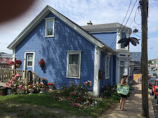
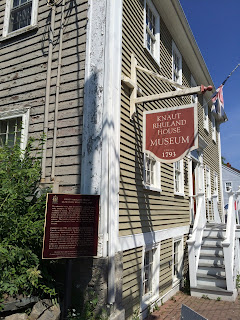
A few examples of the old, but often well preserved buildings on Dock Street


The boat shed


Thursday was grocery day in the morning, and laundry day in the afternoon. I spoke to sailors at the club to learn of issues and advice in crossing the Gulf of Maine, where the Bay of Fundy tidal range, the highest in the world, also creates strong currents that must be considered when navigating these waters.


Friday, we investigated our failing alternator, which didn’t seem to be charging the batteries when the engine was running.  A replacement was eventually found in Bridgwater at Rob’s Starter Repair, and he would courier it to us right away. Thanks, Rob!  That evening we learned that the Lobster Shack was catering for the yacht club’s Friday night dinner, and for $14 each we received a heaping lobster roll with a large serving of pasta salad. Delicious!

 
We have taken a liking to lobster rolls here in Nova Scotia!

The schooner Columbia in one of the races


Saturday, our 3rd month after leaving the North Channel Yacht Club in Spragge, Ontario, we visited the Shelburne farmer’s market, and drove Vata to the fuel dock for diesel and water. It rained here all afternoon, and most of Sunday, so we took care of a few chores on the boat, and we came over to the yacht club to charge our computer and update the blog.
Part of the historic waterfront on Dock Street as seen from our place in the anchorage.

The Mist of Avalon from Liverpool NS in Shelburne

Friday, 4 August 2017

The Bluenose Coast


Monday, July 31, 2017 we left the Northwest Arm in Halifax Harbour. It took a while to raise the anchor because with the anchor came up 50 lbs of kelp! But before we could leave Halifax, we had to take a side trip long the waterfront to see the tall ships again. It was a wonderful sight!
One of the container Docks at Halifax Harbour

Tall Ships on Halifax's waterfront


More Tall Ships on Halifax's waterfront


More Tall Ships on Halifax's waterfront and some Navy Ships nearing the Narrows

Container Ship Tiea entering Halifax Harbour


Then we left the harbour and rounded Chebucto Head and made our way westerly towards Prospect, NS. We tried to anchor outside Prospect, but the anchor would not hold in the soft mud, and instead found a more secure anchorage a few miles to the north behind Purcell's Island.


The next morning, we continued westerly, but with the goal of visiting Peggy’s Cove by dinghy, we had to be strategic. We anchored to the east of Peggy’s Cove near West Dover, off of a group of islands that protected the bay from the Atlantic’s swell. It was a short sail, so we completed a few maintenance chores on board, then got into the dinghy to go exploring.  The scenery here is unbelievable! Rugged white granite islands with hardly any soil, vegetated with shrubs and stunted spruce trees.

The water was crystal clear, and we were amazed at the biodiversity in the seabed! We found an island that we could land, and hiked around. Just beautiful!


In the afternoon, we decided to go into town. We saw a very nice fishing village of West Dover, with many lobster traps neatly piled on the docks. We stopped at “Shaw’s Landing” to sample their menu, and had mussels, fries, and a couple of Keith’s. They advertise on their road sign: “Beer and Lobster - enough said.” The food and the service was excellent, and no wonder they are recognized by TripAdvisor and claim to be the best seafood place in the Maritimes!
View of West Dover's fishing fleet from Shaw's Landing.


August 2 ,2017, we got up, had breakfast, and got in the dinghy and headed southwest to Peggy’s Cove! The seas were calm as forecasted, with just a bit of a swell. As we neared the famous lighthouse, we took a few pictures. There were already quite a few people there, and it was only 9:30 a.m.! 
Dinghying around Peggy's Cove Lighthouse
We dinghied around the lighthouse and into the Peggy’s Cove Harbour – that was a beautiful sight!  Very picturesque with fishing boats, protected historic buildings, docks piled up with lobster traps, rope and floats… and the rocky landscape. We tied up at a dock and walked to the iconic lighthouse. With our sea legs, we were staggering all over the road, but the cars and busses were patient. The lighthouse was freshly painted white and red, and sitting on smooth white granite with the Atlantic in the background was stunning!!

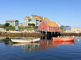
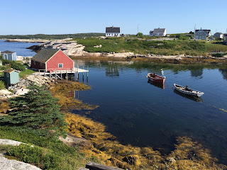
Fishing buildings and Peggy's Cove Harbour


The iconic Peggy's Cove Lighthouse


We went back to our anchorage and made way to Mahone Bay, as we sailed past Peggy’s Cove Lighthouse, packed with hundreds of visitors. A beautiful sailing day! We anchored between the Second Peninsula and Heckman’s Island, with a pretty landscape all around us: the open bay to the east; to the south, some houses nestled in the trees with docks and moored boats; then a forested point with a fine sand beach, and a hillside with some land cleared for pasture and a barn, a few horses, and a “green-gables-style” farm house; to the north, where we entered the bay, a dairy farm with a number of buildings and a herd of Holsteins.
Beautiful scenery near Heckman's Island

A dairy farm near the anchorage - and the fog rolling in in the distance...

The fog begins. Further pictures are just gray.
Then the fog rolled in – thick! We couldn’t see a thing, but we knew we were surrounded by beauty!


In the morning we rounded Heckman’s Island and the shoal ground east of the Eastern Points, and turned west into Lunenburg Bay. As we rounded the breakwater protecting Lunenburg Harbour, our jaws dropped at the beautiful sight in front of us!  Beyond words, we just laughed! 
Old Town Lunenburg, Nova Scotia
Lunenburg is a UNESCO World Heritage Site recognised for preservation of Old Town, for having the best example of a British Colonial grid-pattern street layout, and for it’s authenticity as a working town.  The entire 48 blocks of Old Town Lunenburg are also a National Historical District. The buildings are colourful and well preserved. An awesome sight!

Zwicker Wharf's dinghy dock

Ironworks Distillery


We needed to fill our tanks with water, and were fortunate to find a spot at Zwicker Wharf in downtown Lunenburg. Afterwards we did groceries, and left the dock for the anchorage by the mooring field across the harbour channel. We dinghied back to Zwicker Wharf’s dinghy dock and explored Lunenburg by foot.  The next day we walked more, and saw more. And we ate seafood, and visitied National Heritage Buildings and took in the sights.